The Anthropocene Surge - evolution, expansion and depth of Vienna’s urban environment
01/2018 - 12/2021 Vienna Science and Technology Fund (WWTF ESR17-040)
Principal Investigators:
Michael Wagreich (University of Vienna)
Katrin Hornek (University for Applied Arts, Vienna)
www.katrinhornek.net
PhDs:
Kira Lappé
Maria Meszar
Cooperations with:
Christine Jawecki (Vienna Municipal Department MA29, Bridge Construction and Foundation Engineering)
Martin Mosser (Vienna Urban Archaeology)
Clemens Porpazcy (Austrian Geological Survey)
Erich Draganits (Department of Geology, University of Vienna)
Karin Hain (Isotope Physics/VERA, University of Vienna)
The project looks at the growth of anthropogenic influence in the urban environments of Vienna and it surroundings by applying classifications of anthropogenic sediments, evaluating geometry and topography, 3D models, geochemical methods to characterize the Anthropocene and historical maps.
The main methods are sedimentology and geochemistry, i.e. trace metal enrichment of urban anthropogenic strata, and stratigraphic methods. Animations and an essay film will accompany the research and digitization process of Vienna’s multilayered underground which aims to re-frame natural and human induced shaping-forces causing social and geological environments to materialize in forms and recording the scientific flow of material from strata to data.
Project Website: https://anthropocene-vienna.univie.ac.at/

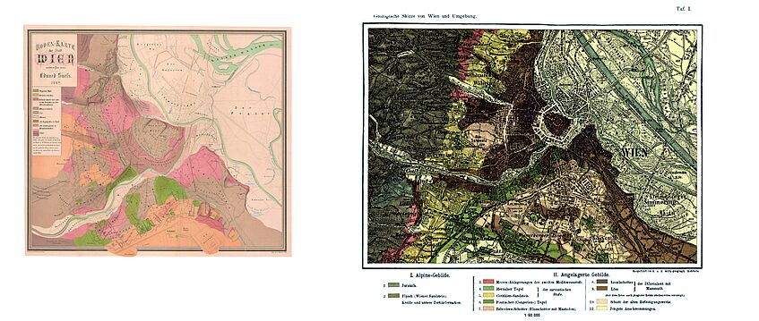
The first geological map of Vienna by Eduard Suess (1862) already included anthropogenic deposits ("Schuttdecke"), and was further elaborated 1897, exemplifying the growing extend of anthropogenic influence.
(taken from:
Suess, E., 1862. Der Boden der Stadt Wien nach seiner Bildungsweise, Beschaffenheit und seinen Beziehungen zum Bürgerlichen Leben. Wien, Wilhelm Braumüller, 326 pp.
and
Suess, E., 1897. Der Boden der Stadt Wien und sein Relief + geol. Karte, 1897. 26 pp.)

