Earth’s Ancient Glacial Archive: What is normal on Earth?
In today’s world, with seemingly unending natural disasters, melting glaciers and record beating annual temperatures year on year, it is right that we ask the question: “what is normal?”
The Earth has experienced many severe ice ages in its history, with Palaeoproterozoic, Cryogenian, Ediacaran, Early Palaeozoic, Late Palaeozoic, and even the otherwise warm Cretaceous period containing records for intense glaciation.
Some of these glaciations, such as the Cryogenian examples appear to have a record largely preserved in rift basins, and where tectonics played a major role.
The snowball Earth hypothesis continues to be debated.
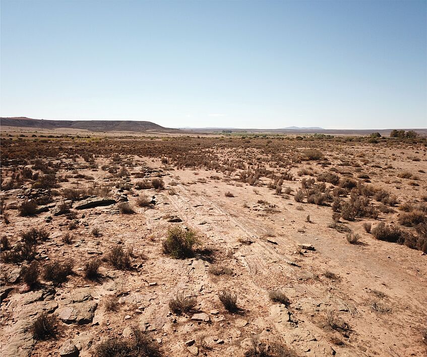
Other glacial records, such as the Late Ordovician deposits of North Africa, are extremely sandy, and have less in common with Quaternary or modern records. Still others have an exceptional preservation, with exquisite striated pebbles, tillites, and striated pavements that rivals features in modern glaciated landscapes (e.g. the Dwyka Formation in southern Africa).
We ask ourselves which of these records, if any, is truly representative of icehouse intervals on Earth, and which are exceptions.
This question transcends simple facies analysis, and routine job of making predictions about how sedimentary sequences are laid down, and challenges us to think about if, and perhaps how, we should adapt our uniformitarian view of the world.

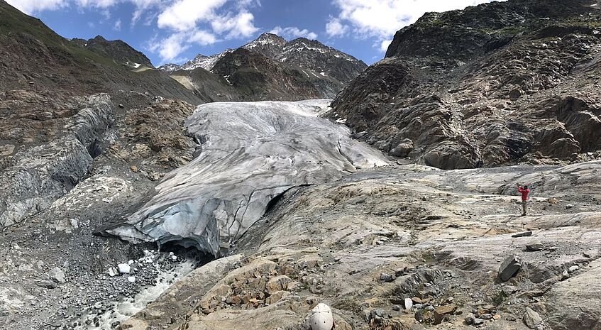
The Gepatsch Glacier terminus in Kaunertal - a printing machine for subglacial bedforms (© D. Le Heron).
To this end, in our group, we are currently studying the glacial sedimentary records of Tirol (Austria. Pleistocene to recent), China (Ediacaran) and Namibia (Late Palaeozoic).
Our current collaborators include colleagues from the UK (Dr Bethan Davies, Dr Marie Busfield, Prof. Charlie Bristow, Prof. Graham Shields, Mr Tom Vandyk), France (Dr Jean-Francois Ghienne, Dr Pierre Dietrich), the USA (Prof. Isabel Montanez, Dr Neil Griffis) and China (Prof. Yongqing Liu, Prof. Hongwei Kuang, Prof. Guanghui Wu, Mr Xiaoshuai Chen) and Dr Bertus Smith (South Africa).
We employ traditional fieldwork, sedimentology and mapping, coupled with photogrammetry and follow-up lab work in our endeavours.
Thinking the unthinkable: how can we extract fabric information from featureless rocks?

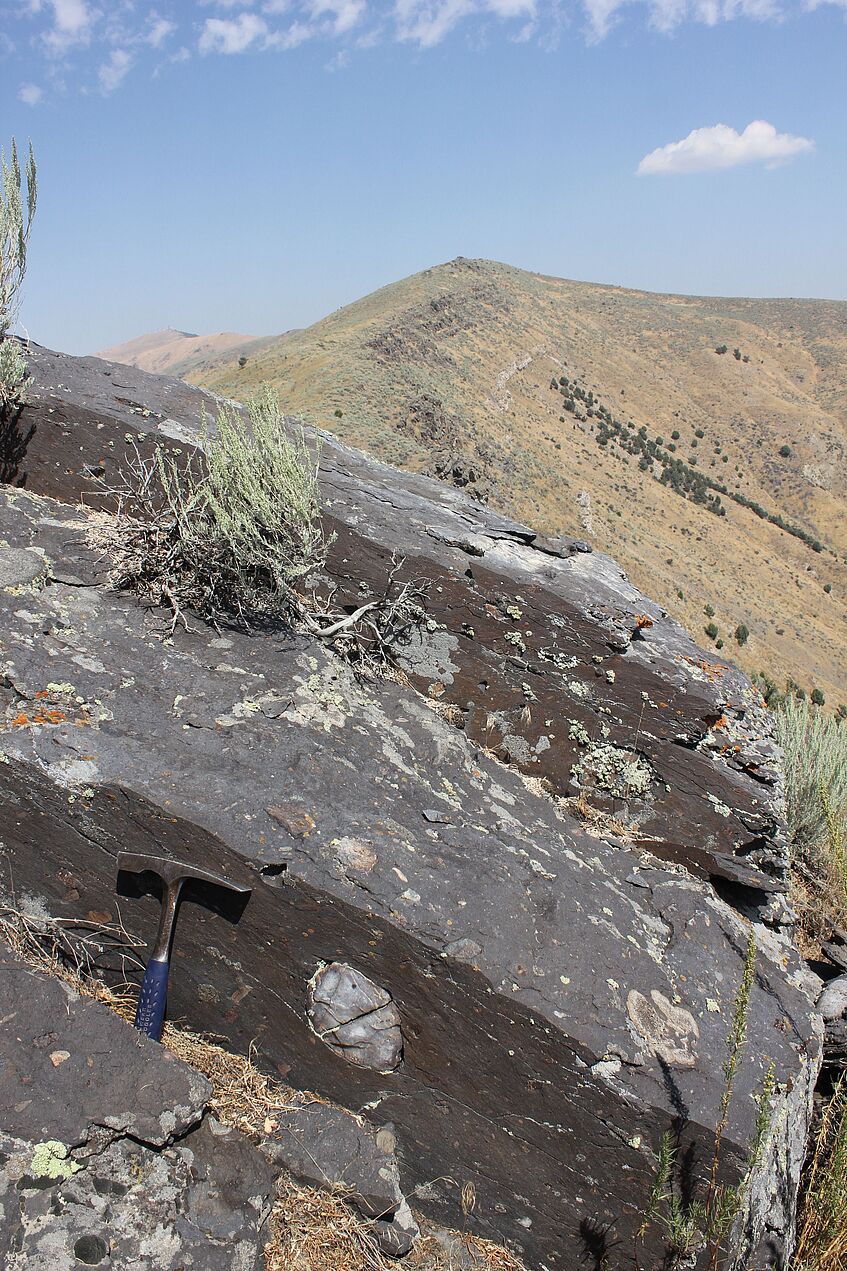
A structureless diamictite, about 720-660 Ma old, from the Dutch Peak Formation of Idaho. Extraction of fabric information is possible from many such outcrops, revealing vital new insight into the flow direction of ancient ice sheets (© D. Le Heron).
Diamictites are unsorted, lithified deposits that can form in a variety of ways, such as through slurries (debris flows) or by glacial processes.
In the rock record, diamictites often pose the geologist huge challenges: how do we approach something that looks, at least at first glance, featureless. And how can we say anything meaningful about it?
In our group, applying fabric techniques developed from Quaternary glacial records, we are learning how to extract three dimensional fabric data out of apparently featureless rock. This means building up an x-y-z cube of planar or linear fabric data.
If we are sure that a diamictite is laid down in a glacial (we need supporting evidence to do that, such as striated clasts, pavements, dropstones, facetted clasts etc etc), then this can allow us to constrain the flow direction of the glacier much more precisely.
In non-glacial contexts, e.g. mass flows, we can also use this approach to constrain flow direction, with major implications for constraining palaeogeographic models in a variety of different basin contexts.
A bird’s eye view
Digital capture of outcrops - be it LiDAR scanning or aerial photography- allows the geologist to get to take a virtual copy of an outcrop back to the lab with her/himself.
This approach is well established in some quarters of geoscience (e.g. petroleum reservoir outcrop analogue characterisation, studies of stepwise evolution of glacier forefields etc) but is rarely applied to the ancient record.
We try to look at glacial landscapes and glacial sediments from every possible scale, drawing on satellite image interpretation and aerial photographs in addition to fieldwork and state of the art lab analysis.
For example, we have been mapping the Late Palaeozoic glacial landsystem of northern Chad, and Ediacaran glacial landscapes of China and Australia in a number of ongoing projects.
This work is revealing that surfaces that are carved and eroded beneath ice masses reveal a great deal about the evolution of the overriding ice mass. Where such surfaces are cut into soft sediment, they can even point to multiple phases of incision, decoupling, and complex basal behaviour during retreat.

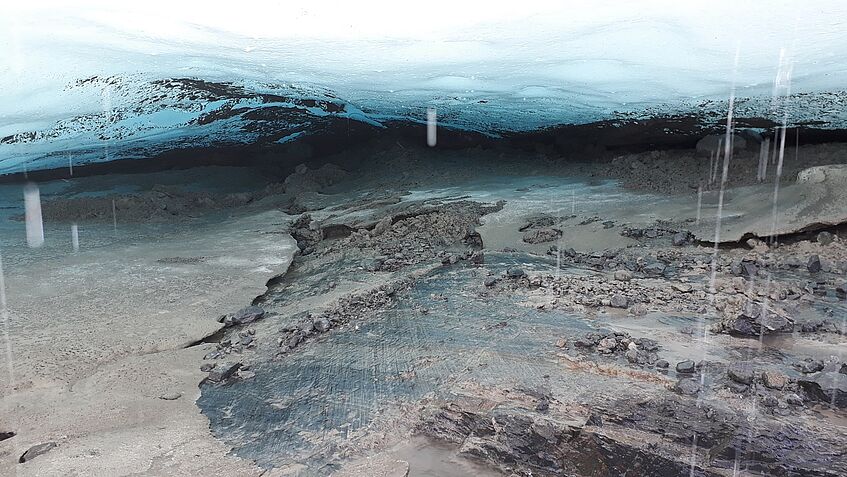
Striated surface in an ice cave beneath the Gepatsch Glacier in Kauntertal, Tirol, in July 2019 (© D. Le Heron).
Collaborators:
Jürgen Reitner and Gerit Griesmeier (Geologische Bundesanstalt)

