Coupled continuum-discontinuum modelling of salt tectonics

2013-2015, 2016-2019: Research projects funded by Statoil ASA
Principal Investigators:
Martin Schöpfer (University of Vienna)
Bernhard Grasemann (University of Vienna)
Collaborators:
Florian Lehner (University of Salzburg)
Ben Huet (University of Vienna)

Description:
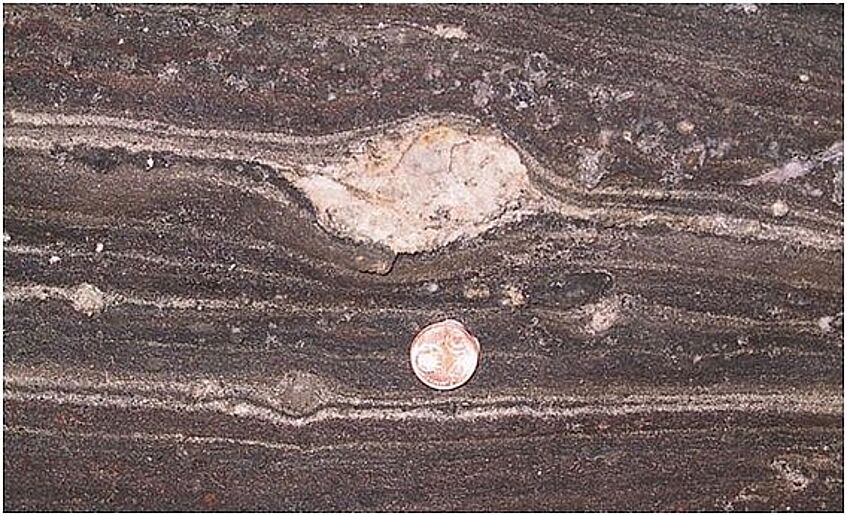
Rock salt is mechanically weak and flows like a fluid at geologically strain rates. Salt is also less dense than compacted siliciclastic rocks.
The presence of salt in sedimentary basins hence causes unstable conditions which lead to characteristic deformation patterns in the (brittle) overburden.
Salt domes or diapirs, for example, have long been recognized as manifestations of the extraordinary mobility of rock salt.
A wide variety of hydrocarbon traps are associated with salt tectonics. These have been documented in many modelling studies aiming at an understanding of the structural styles that develop in such settings.
Analogue modelling studies have typically employed dry sand for modelling an elasto-plastic sedimentary overburden and viscous materials (e.g. silicone putty) for the ductile substratum (e.g. salt). Although analogue modelling is a valuable tool for studying salt tectonics, problems may arise from improper scaling of elastic overburden properties or density differences and resulting buoyancy forces.
Numerical modelling by means of Finite Elements (FE) can overcome these scaling problems but is however ill-suited for modelling large, discontinuous displacements.
In this project we employ the Distinct Element Method (DEM), which is the ideal tool for modelling large discontinuous deformation (e.g. faulting in a brittle overburden), while deformation of the ductile substratum is captured by a continuum description.
We therefore combine the strengths of both discontinuum and continuum models to produce new insights into the mechanical evolution of structures associated with salt tectonics.
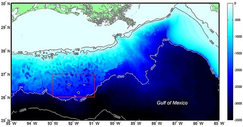
Manifestation of salt flow at a large scale: Bathymetric map of the northern Gulf of Mexico. Red rectangle is location of map shown below. The patchy contour pattern of the continental margin is due to sediment progradation across (allochthonous) salt. Data from the National Geophysical Data Center, map generated by M. Schöpfer.
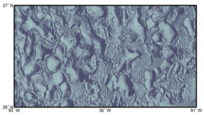
Manifestation of salt flow at a large scale: Shaded relief map of an area located in the so-called central province of the northern Gulf of Mexico (see map above for location). Salt diapirism and local subsidence form a complex network of elliptical minibasins. Data from the National Geophysical Data Center, map generated by M. Schöpfer.


